Hike/trip report: Colorado Trail (2025)
In the fall of 2024, I completed the Tahoe Rim Trail, my first thru-hike, and started wondering what was next. I wanted to do something that would continue to push my hiking abilities, since the TRT went well. I'm not sure how I eventually decided on the Colorado Trail, but there were several things that appealed to me. In particular,
- Longer: more time to get my trail legs under me and see what I could do over the course of the hike; more resupply logistics to contend with. Still doable while taking PTO from work and not having to quit or arrange a longer leave of absence.
- Higher altitude: I wanted to see how my body would cope with an average elevation of over 10,000 ft (3000m).
- Storms: Colorado is known for intense monsoon-season thunderstorms. I'm familiar with these storms from having spent a lot of time in northern Arizona, which also is impacted by the monsoon, and have always found them fascinating. Having to deal with them while outside and often above treeline would add an interesting logistical component to this hike.
- Peak hiking season: Was interested in the community aspect of trail after seeing only one other thru-hiker on the Tahoe Rim Trail. Peak season also means more light, which means longer hiking hours.
- No permit: I could choose to start when I wanted to.
Logistics and Planning
Timeframe
The lack of a permit was a blessing—it meant that I could start the hike whenever I wanted to—going later if it was a high snow winter in Colorado or earlier to get slightly longer days. With an average to below-average snow year, I decided to set out the last weekend in June to take advantage of my two corporate holidays around July 4th.
Getting there
I booked an early (6:30am) flight from SFO to DEN.
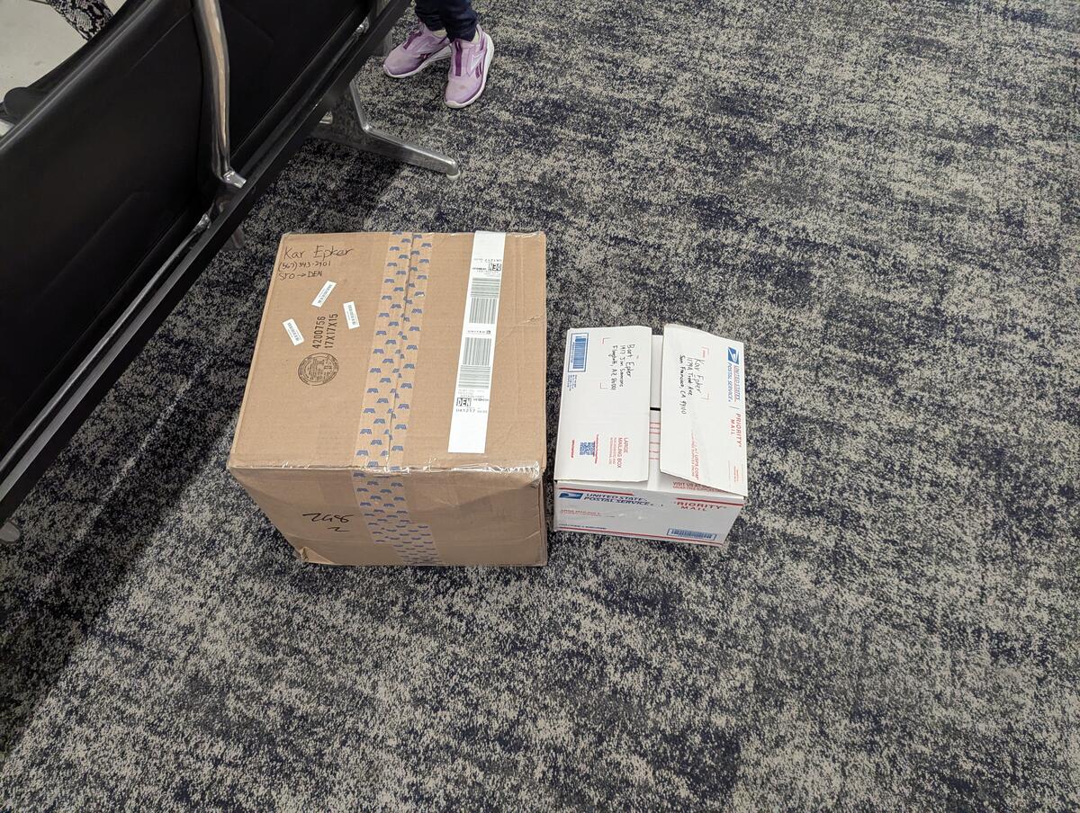
To get my gear through security, I picked up a box for free from a U-Haul store and basically put all my hiking gear in it, since I wouldn't need it on the flight. Upon getting to Denver, I repacked my pack and recycled the box.
I took public transit most of the way from DEN to Waterton Canyon—the northern terminus of the Colorado Trail—the train from the airport into downtown, and then another train to Littleton, then rideshare to the trailhead.
Resupply
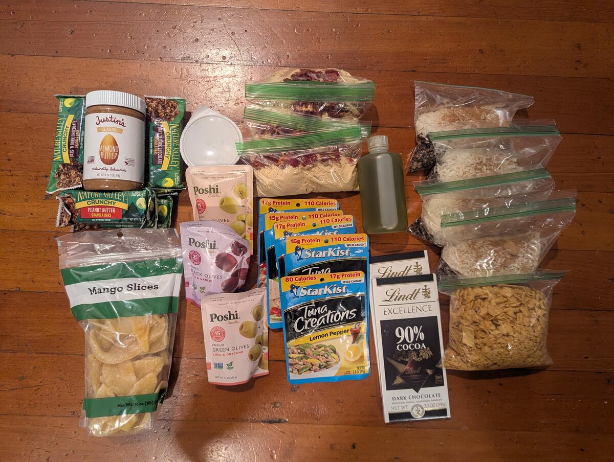
I semi-purposefully did not send myself resupply boxes. I didn't want to do this because I was worried I'd get sick of certain foods, but I also just ran out of time to put resupply boxes together, so I started with ~5 nights of food to get me from Denver to Breckenridge (my first resupply). I did plan my resupply points before the trip, but this wasn't necessary in retrospect. Since I didn't have any boxes, I could have figured it out on the fly. My original intended resupply locations were at mile markers:
- 102.5 (+102.5 miles): Breckenridge.
- 175 (+72.5 miles excluding Mt. Elbert side trip): Leadville from Twin Lakes.
- < 260 (on Collegiate West) (+85 miles): Salida (East) or Gunnison (West).
- 356 (+95ish miles): Lake City.
- 409 (+50ish miles): Silverton.
- 486 (+75ish miles): Durango.
Gear
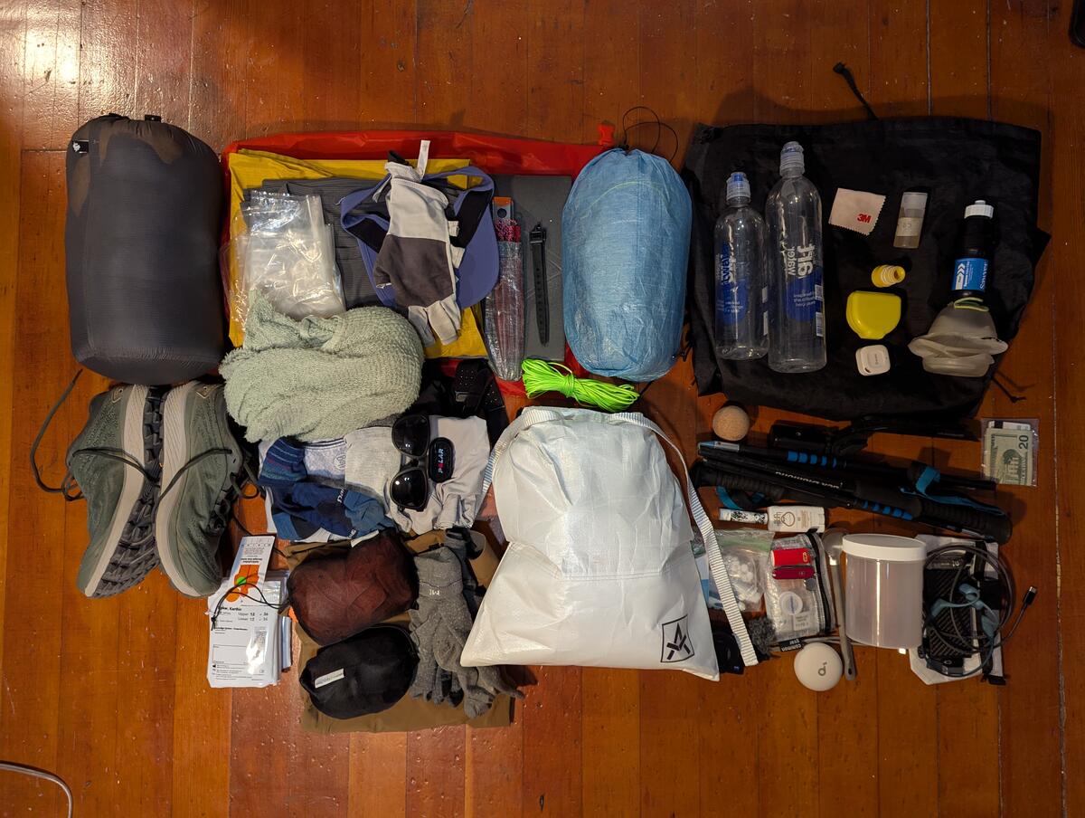
- My base weight was around 11 lbs, which is not quite ultralight, though there are a few items in the gray area, e.g. I do not consider my trekking poles worn weight because I often hike without them.
- My total pack weight after a typical resupply would usually be between 20 and 25 lbs.
Most of my kit I kept from the Tahoe Rim Trail, but made a few notable gear changes.
Rain Jacket
For the Tahoe Rim Trail, which does not receive summer thunderstorms that are as intense as those in Colorado, I brought a cheap disposable plastic poncho (which I never used), and a wind jacket.
For the CT, I wanted something a little more dependable. Some options I considered with my notes at the time:
- EE Visp: Not available in Men's Medium (my size).
- Montbell Versalite: Not available in California (presumably because it contains PFAS).
- Frogg Toggs
- Cheap and light, but fragile and barebones.
- Is fragile an issue? There's not a lot of bushwhacking on the CT?
- LightHeartGear jacket
- Apparently the arms are too short and custom arm length is +$75.
- Good features (pit zips, etc.)
- Not DWR.
- Good price (not including the custom arm length).
- AntiGravityGear
- Similar to LightHeartGear (non-DWR, pit zips, etc.), but seems like it's better than LightHeartGear.
- Should get the seam sealing done (+$20).
- Actually fairly cheap < $150 even with seam sealing service.
- A little heavier than LightHeartGear and the other options.
I ended up getting the AntiGravityGear jacket, having been convinced by Andrew Skurka that non-DWR rain gear is actually superior in the types of storms that Colorado gets. I was turned off the LightHeartGear jacket by numerous reports that the arms were too short.
Shoes
I used the original Topo Pursuits while hiking the TRT and loved them. They are no longer available, so I picked up the Topo Pursuit 2s for the CT. I used these basically stock, not even replacing the insole, which I sometimes like to do for running shoes.
Bear Bag
I was required to carry a bear canister on the TRT. This was actually nice for my first thru-hike: it's a foolproof solution so I didn't have to think about it.
The CT is less restrictive with food storage. There's a Forest Service order that was put out in 2023 that says that all food must be hung or stored in a hard-sided container, but the consensus online is that bear-resistant/proof food storage bags are allowed. I called one of the Forest Service stations to confirm, and they also said this was fine. In practice, many hikers did not even bother to hang their food bags, bear-resistant or not, and I never saw any rangers that checked food storage.
I bought a 14 L Adotec black bear bag for food storage. I considered an Ursack as well, but the Adotec bags are lighter and higher capacity than the equivalent Ursack (7.6 oz for 11L of storage in the Ursack Major vs. 6.6 oz for 14 L of storage for the 14 L Adotec black bear bag). The Adotec bags are also rodent resistant, while rodent resistance requires buying a higher tier version of the Ursack (the "AllMitey").
I supplemented my bear bag with rope, since I was interested in learning bear hangs anyway, despite warnings I've heard against them.
Puffy
I didn't really use my puffy much on the TRT, so I decided to drop it from my kit for this trip. Puffys are useful when static in camp, but I don't tend to spend too much time sitting in camp, and figured that my fleece and rain jacket would be good enough insulation if I needed it before I got into my quilt to sleep.
Skills
They say the most ultralight piece of equipment is the thing between your ears, so I picked up a few new skills before heading out.
Bear bag hang
In particular, I wanted to learn bear bag hangs and associated skills for this trip.
I watched a few videos on Youtube of hangs I wanted to learn:
- PCT method: https://www.youtube.com/watch?v=UUmdXOcLyNA
- Single evergreen method: https://www.youtube.com/watch?v=peE0ut0zBHU
- Two tree method: https://www.youtube.com/watch?v=aRRA8FP1zLY
There actually can be quite a lot of gear associated with some bear bag hangs (rock sack, locking carabiner, etc), so I learned some additional knots so I just had to bring the rope.
- Bowline knot: For tying the rope to my food bag. I planned on doing this instead of using a carabiner. I'm a bit puzzled why this isn't more widely recommended instead of using a carabiner. It's not like bringing a carabiner prevents you from having to learn this knot because you'd still need it to tie the rope to the carabiner.
- Clove hitch: Instead of using a rock sack, you can clove hitch the rope to a rock and add an additional half hitch to secure it.
During the hike
Hiking stats
I started hiking on Saturday, June 28th, 2025 shortly before 15:30 and finished shortly after 13:00 on Monday, July 21st, a total of 23 days. Here's a brief daily synopsis, including start and end trail miles. Note that the Collegiate West is an alternate of the Colorado Trail which has its own mileage:
| Day | Description | Start mile | End mile | Trail distance (miles) | Tracked distance (miles) | Tracked gain (ft) | Link |
|---|---|---|---|---|---|---|---|
| 0 | Unacclimated and hot in Waterton Canyon. | 0 | 12.5 | 12.5 | 13 | 1600 | Strava |
| 1 | South Platte River; exposed segment 2; fire station. | 12.5 | 36.5 | 24 | 25 | 3800 | Strava |
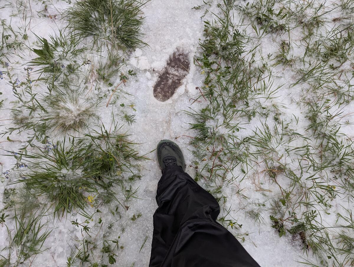
| 2 | Up above 10k ft for the first time; major hail storm! | 36.5 | 57 | 20.5 | 22 | 4400 | Strava |
| 3 | Kenosha pass; bad bug night. | 57 | 78 | 21 | 22 | 2900 | Strava |
| 4 | First time above treeline (Georgia pass); push to Breckenridge. | 78 | 102.5 | 24.5 | 25 | 3600 | Strava |
| 5 | Zero in Breckenridge. | 102.5 | 102.5 | 0 | 0 | 0 | |
| 6 | Almost double passes; Copper mountain. | 102.5 | 124.5 | 22 | 23 | 6300 | Strava |
| 7 | Extended section above treeline; bad bug night. | 124.5 | 146.5 | 22 | 23 | 3300 | Strava |
| 8 | Holy Cross and Mt. Massive Wilderness; bad bugs but escaped by night. | 146.5 | 169.5 | 23 | 24 | 4900 | Strava |
| 9 | Mt. Elbert side trip. | 169.5 | 179.5 | 10 | 16.5 | 4000 | Strava |
| 10 | Zero in Leadville. | 179.5 | 179.5 | 0 | 0 | 0 | |
| 11 | Collegiate West; big day; bad bugs to Hope Pass; Lake Ann Pass. | 179.5 | CW 23 | 25.5 | 26.5 | 7200 | Strava |
| 12 | Pushing over 12,000 ft+ passes; windy then smoky. | CW 23 | CW 49 | 26 | 27 | 6500 | Strava |
| 13 | Rush to Monarch Pass by nightfall. | CW 49 | CW 76.5 | 27.5 | 28.5 | 6200 | Strava |
| 14 | Zero in Salida / Monarch Pass. | CW 76.5 | CW 76.5 | 0 | 0 | 0 | |
| 15 | Bring on the big miles; approaching cow country. | CW 76.5 | 286 | 30.5 | 32 | 5000 | Strava |
| 16 | Sargents Mesa; cow country. | 286 | 317 | 31 | 31.5 | 4100 | Strava |
| 17 | Escape from cow country; San Luis Peak. | 317 | 340 | 23 | 25.5 | 5900 | Strava |
| 18 | Snow Mesa with storms all around; Lake City. | 340 | 356 | 16 | 16.5 | 3700 | Strava |
| 19 | Lake City shuttle; San Juans; CT high point. | 356 | 375 | 19 | 18 | 3300 | Strava |
| 20 | Classic Colorado storm; CT/CDT divergence; Elk Creek Canyon. | 375 | 404 | 29 | 30 | 5200 | Strava |
| 21 | All the way back up above treeline; drizzle. | 404 | 432 | 28 | 29.5 | 6600 | Strava |
| 22 | End of San Juans; hot and dry; peer pressured into additional miles. | 432 | 469 | 37 | 38 | 5700 | Strava |
| 23 | Downhill roll to Durango. | 469 | 483 | 14 | 15 | 1500 | Strava |
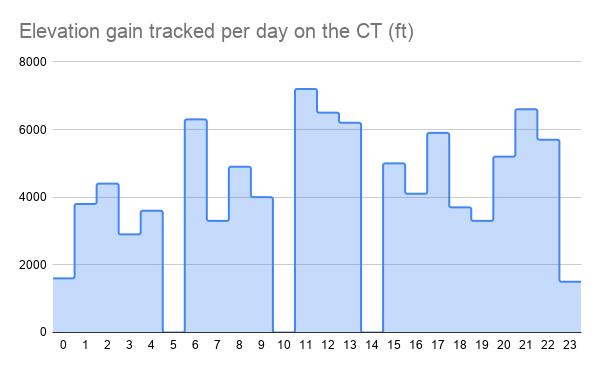
Some of the stats in graph form (see this spreadsheet for interactive versions).
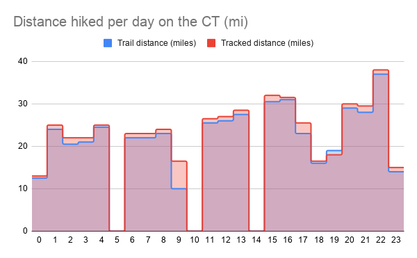
Tracked distance is from my watch and the trail distance is from FarOut. My watch tended to track a mile or so more of distance than I traveled on FarOut. There are a few days with larger differences (9 and 17)—these are days that I did side quests to summit Mt. Elbert and San Luis Peak respectively.
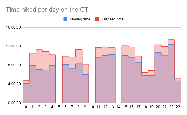
In this graph you can see the gap between my moving time and elapsed time narrow as the hike went on. This is largely because I stopped taking lunch breaks after my zero in Leadville (day 10) and ate lunch on the go.
Pacing and strategy
I didn't plan the distance I would hike before the hike started, but rather went resupply by resupply, so I could carry the appropriate amount of food to get me to town. As a baseline, I used 20+ miles per day, which I figured I could sustain because this was a lower bound on my daily volume on the TRT.
As I expected, I increased the average daily distance over the course of the trip as my body got more accustomed to hiking and I felt more confident I wouldn't injure myself, ramping up to 25-30+ miles per day in Collegiate West and beyond.
I took three zeros:
- Day 5: Zero in Breckenridge.
- Day 10: Zero in Leadville.
- Day 14: Zero in Salida/Monarch Pass.
I had two partial days going into and out of Lake City. I wouldn't call these nearos, since I did 15+ miles each day, but I finished in the afternoon on the first day and started just before noon on the second.
- Day 18: Into Lake City.
- Day 19: Leaving Lake City.
While again, I didn't plan each zero, I expected I'd need them less later in the hike. I badly needed the zero in Breckenridge and wouldn't have said no to a second. In contrast, by the time I hit Lake City the time-off was mostly for town chores and to spend a night in a bed, where I tend to get better sleep.
I originally had planned to do one more town day in Silverton, but ultimately decided against it while in Lake City. A few other hikers said they were planning on hiking the 120ish miles through, and other people I had talked to said Silverton wasn't really worth the stop.
Physical condition
Overall, I felt good for this entire hike, and never felt like I overextended myself or dealt with anything beyond being a bit tired at the end of the day.
I did have a few minor physical issues, some of which I have not root caused:
- The bottoms of my feet would really start aching at the end of some days, and my achilles area would tighten up.
- Back chafing. On day 15, leaving from Monarch Pass, I started to feel like my shirt was pricking my back, like I was lying in thistle. This continued off and on for the rest of the trip. It tended to be worse when it was hot and my back was sweating.
Mental condition
This trail is difficult. Going SOBO into Breckenridge, I was lulled into a false sense of security by the relatively cruisy trail featuring just one pass above treeline. My rude awakening came in Collegiate West, which was one of the hardest parts of the trail for me.
Overall, I was a bit stressed on this trail. This was partially due to external factors; I felt like I was always looking out for storms. Partially, it was internal—I like to push myself physically, e.g. to do an extra peak or just get into town a day earlier. While I enjoy the process of setting and achieving these goals, I sometimes need to chill a bit more. I'd always feel a huge sense of relief when I finally found my camp spot for the night.
Food and nutrition
I aimed to eat at least 3000 calories a day. I have a high resting metabolic rate, and I suspected that even with this intake I'd still lose weight, but at least I'd get a baseline of my caloric needs.
I suspect I lost around 5-10 lbs. I don't know precisely how much since I didn't weigh myself before and after, but I noticed as the trail went on that I cinched my pants increasingly tight.
Despite this, I never experienced "hiker hunger". On trail, I never had to stop myself from digging into another day's food. I would eat a good amount in town, but not significantly more than I eat in general.
While hiking, I converged around eating breakfast and lunch on the go, with something more meal-like for dinner. A typical day of meals would look something like:
- Breakfast: Bars, usually sweeter/richer, like dark chocolate and peanut butter-flavored.
- Lunch: Nuts with whatever variety of seasonings that I could find in town (preferring savory) and some dried fruit.
- Dinner: More traditional cold-soaked "meal". My favorite cold-soaked dinner is dehydrated rice and beans in the style popularized by Andrew Skurka.
Potentially TMI story: My last night on trail, I wanted to use up the rest of my dinner supplies, and had probably 2-3 fl oz left of olive oil that I had been putting in my beans and rice. I decided to use all of it, not wanting to let the calories go to waste. About an hour after I had gone to bed, I sat up, feeling that something was not right. I eventually realized that dinner was not going to stay down and got out of my tent and returned it to nature. We'll see if beans and rice is still my favorite trail dinner the next time I do this.
Spend
I spent about $1300 hiking the CT, not including the cost of gear or flights. My spend breaks down in the following ways:
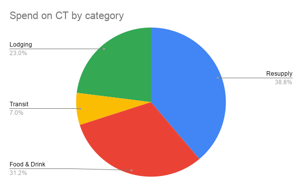
The categories on the graph represent:
- Resupply: Food and drink specifically for consumption on trail.
- Transit: Getting to and from the trail (rideshare, trains, paying people for rides).
- Food & Drink: Meals eaten out, usually while in town. I'd often pack food out from town to eat on my first day back on trail, so the distinction between this and resupply is not perfect.
- Lodging: Places I stayed when not camping.
I was not trying to stick to a specific budget while hiking this trail. I have a well-compensated corporate job, and was happy to spend money eating out when I was in town and to pay for a bed to stay in. There are certainly ways to cut back on spending, though: a truly economical hiker should probably spend as little time in town as possible to reduce cost of lodging and food and drink close to zero, and should instead spend basically all money on resupply.
Camping
I camped 16 nights: 15 on trail and one in a BLM campground outside of Salida. Of the 15 nights I camped on trail, I put my food up in a bear hang 12 nights, and tied my bag around a tree three nights. I never saw any evidence that animals had gone after my food.
I solo camped 12 nights out of 15, with the three nights I camped with others coinciding with the nights I didn't do a bear hang. This was not coincidence—camping near/above treeline and not being able to do a proper bear hang makes me feel more exposed to night critters, so I like the security of camping in a group. The third night I didn't do a bear hang was my last night on trail, when I hiked with someone else until past sunset and used an established campsite. I didn't want to bother others by attempting to do a bear hang when it was late, and I was tired, so I tied off my bag to a tree instead.
I have two camping stories.
On night 12, between 22:30 and 23:00 I suddenly heard footsteps right outside my tent. I immediately went into a panic because hearing unannounced footsteps when it's dark and I'm vulnerable in a tent immediately makes me think I'm gonna get knifed, especially since my camp was relatively accessible near a forest service road that evening. But there was no flashlight, so my mind ruled out human and jumped to bear given how loud the footsteps sounded. I yelled outside a few times to scare the creature off. It had run away by the time I got my flashlight ready, so I never got to see it. Upon further reflection and talking to other hikers, it was probably a deer. I'm just not used to how loud deer footsteps can be because I'd never heard them so close.
Some other creature bothered me on the night 17, coming up to my tent three times before I scared it off. It was probably a marmot, since I was near treeline at that point. I'm not sure what it wanted, since my food bag and smellables were tied to a tree away from where I was sleeping. Another hiker reasoned that because marmots like salt, it was probably interested in my sweaty clothing.
Weather
In contrast to many other people that I met, I was actually pretty excited about getting to see monsoon season storms in Colorado. I love watching thunderstorms roll through and rarely ever get to see them in the bay area. Having spent a lot of time in Flagstaff as well, I'm familiar with the rhythm of monsoon season storms—the storms come through in the afternoon, and the dangerous parts (the thunder and lightning) often pass quickly. Often the rain will pass quickly too.
I was a bit disappointed then that the monsoon was rather anemic this year. While I did stress more than I thought I would when I saw menacing clouds, there were really only two times that I had to stop due to storms appearing. Locals confirmed that this storm season was on the less active side.
There were some storms at night, but these were also rather weak—I probably could have slept with my tent vestibule open, but closed it only to keep my shoes dry.
I didn't find the temperature too extreme either. I was very comfortable in my 20° quilt, and actually a bit too warm the first few nights. I didn't wear any of my warm clothes while sleeping, just a light shirt and shorts. The temperature never got below freezing where I camped, though I purposefully avoid the popular spots near water, which tend to collect cold air. Other hikers near streams did experience freezing temperatures.
Here's a temperature graph from the small thermometer I carried on the outside of my pack:
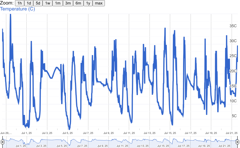
While this graph purports to show some incredibly high temperatures, these are probably not accurate. Official temperature measurements are taken in the shade, but my thermometer was on the outside or my pack, and I suspect it measured the higher temperatures in the sun.
Bug pressure
Unfortunately, despite having a drier hike than I expected and trying to camp away from water sources, I experienced several days and nights with rather unpleasant mosquitoes:
- First, a notable miss: while I read reports of bugs in the Lost Creek Wilderness, I didn't experience any. The storm that came through in the late afternoon dropped the temperature below what mosquitoes can tolerate, so I ate dinner undisturbed.
- The first bad night was below Georgia pass around mile 80. I put on my full rain gear and still walked around while eating dinner to prevent them from landing on me. The mosquitoes persisted over Georgia Pass the next morning, though I was able to stop at the Swan River around mile 90 and eat lunch in peace.
- The second bad night was just before entering the Holy Cross wilderness around mile 146. The following day was probably my worst day of mosquitoes—I had to put on rain gear when I stopped for breakfast around mile 150 and then again when I stopped for lunch in the Mt. Massive Wilderness at mile 160. Surprisingly, just after leaving the Mt. Massive Wilderness and stopping at Halfmoon Creek at mile 168, I did not see any mosquitoes and was able to have dinner and camp at mile 169 undisturbed.
- The final place with bad mosquitoes was around Twin Lakes. I didn't have any mosquito issues when I hitched into Leadville on the afternoon of day 9, but upon returning the morning of day 11, the mosquitoes were so bad I didn't stop to eat breakfast until getting to Hope Pass (mile 7.3 on Collegiate West) where it was windy. Talking to other SOBO hikers after this point, most mentioned this area as the worst bug pressure they experienced on trail. That same evening, camping several miles past Lake Ann Pass, was also buggy, though I accidentally set up close to a small stream.
My experiences with bugs generally agreed with what I read online: the mosquitoes are bad around Leadville, with my one addition being that they were also bad for me around Georgia Pass. I did see some mosquitoes on the second half of the CT, but in general, they seemed a lot less aggressive. They were lazy and slow enough that I could usually just blow them away if they got too close.
Overall, I would not describe the bug pressure as bad, but it was still worse than I expected, especially after seeing essentially no mosquitoes on the TRT last year. I never applied DEET or permethrin but did find it useful to use my rain gear as a physical barrier. I was also very glad to have a tent instead of a tarp as a shelter. There is nothing more satisfying than seeing mosquitoes struggle against netting while trying to bite you. They do tend to go away when the temperature drops at night, but the shelter was nice in the evening before the temperature dropped.
Trail conditions
The Colorado Trail is quite well-marked. Numerous CDT hikers commented on how much easier it was to follow than the rest of the CDT.
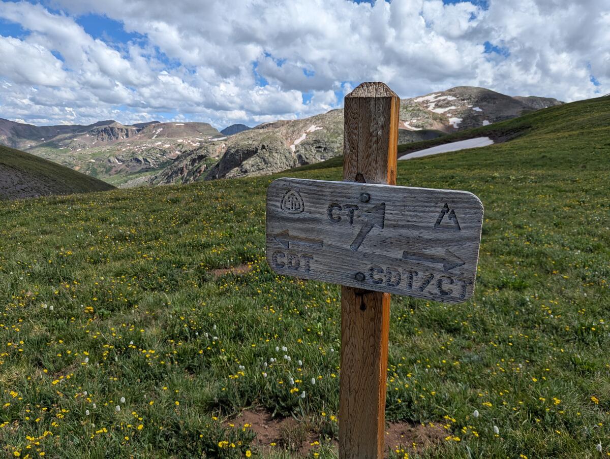
That said, it is not quite as meticulously maintained as the TRT. The grade is steeper in many places, leading me to start calling it "Wall-orado". While AT and eastern US hikers will probably laugh at this characterization, the grade really killed my ambitions of hiking 3+ mph (5 km/hr) as I did for basically the whole TRT. The trail itself runs the gamut from muddy in a few places (annoying but usually avoidable), to pure talus, to mountain bike-rutted, to nicely-dusted in pine duff.
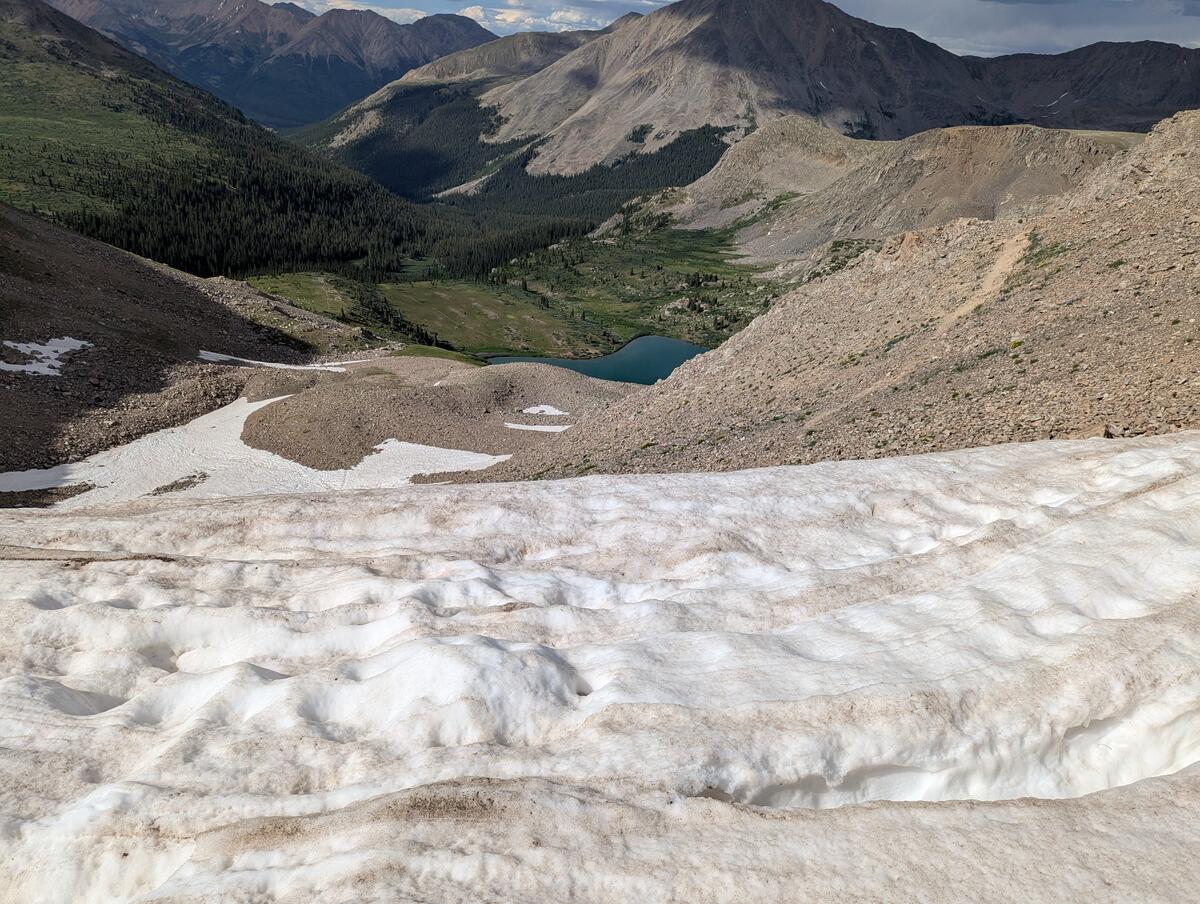
There were sections of snow, but most posed a minor inconvenience at most. The only exception was a large snowbank on the north side of Lake Ann Pass, which required some routefinding and class two hiking to get around.
Plants
I expected Colorado to be like the Flagstaff area: a clear underbrush with well-spaced pine trees. This was not true at all—the majority of trail is actually quite wet, with short water carries due to numerous mountain streams, and lots of lush plants below treeline. My other nickname for Colorado was Co-lush-rado, given how thick the undergrowth was at points. Ironically, the driest parts of the trail tended to be at lower elevations.
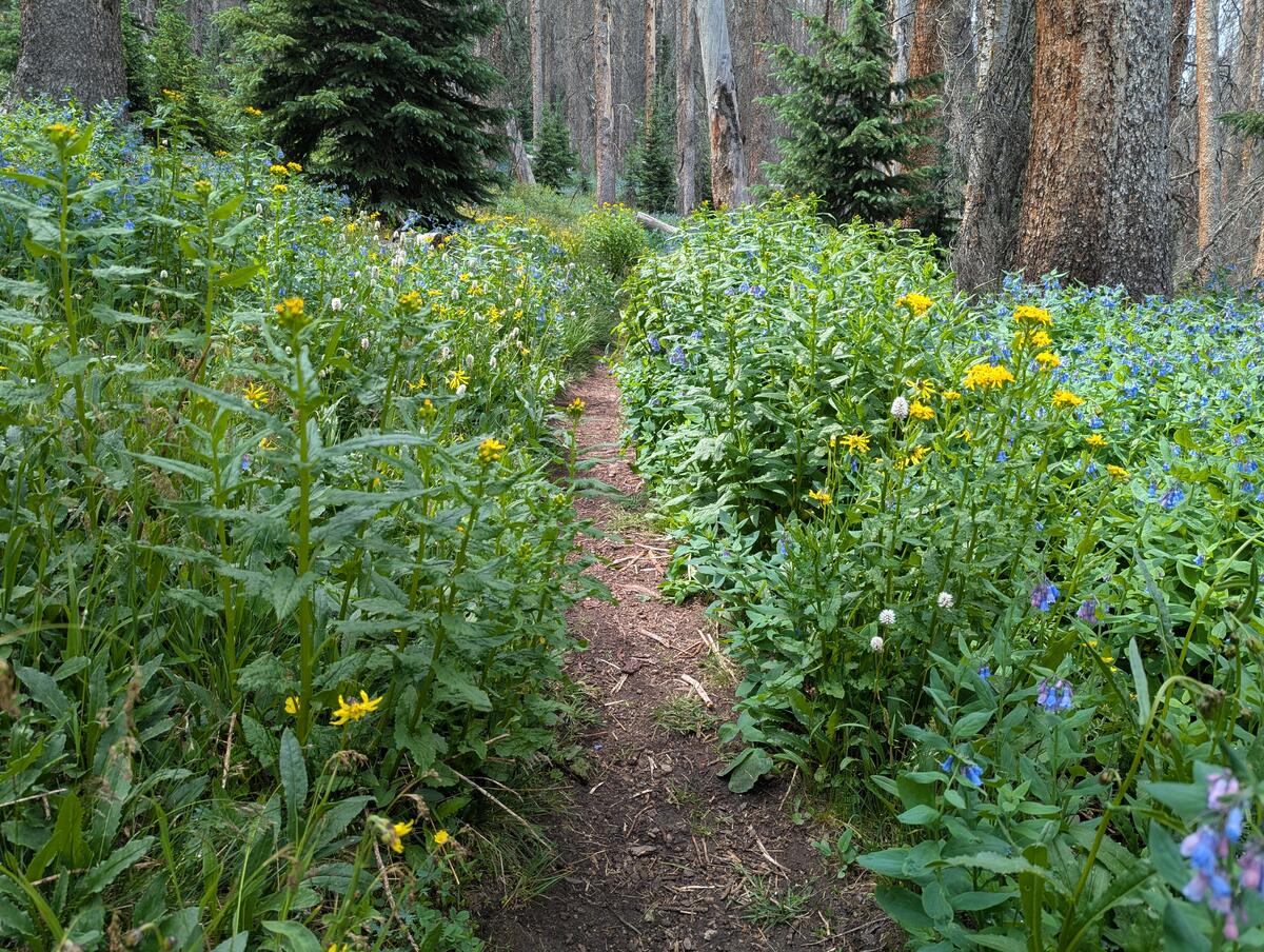
July is wildflower season, and here Colorado delivered. My dislike of the brush below treeline was tempered by the fact that even it was flowering, but I saw the most picturesque scenes of wildflowers above treeline: yellow, white, purple, pink, and orange/red dotting backgrounds of green mountains.
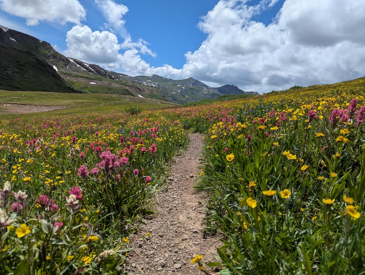
With flowers usually comes sneezing for me, since I am sensitive to plant pollen and usually deal with seasonal allergies in the spring. Usually it wasn't too bad; I never took any allergy medicine, though at night my nose was often stuffy. My worst night was actually when I set up in a grass field and could not stop sneezing. I woke up the next morning and found my belongings dusted in pollen.
The least aesthetic parts of trail were the rather large sections that have been devastated by bark beetle, mostly between Monarch Pass and Spring Creek Pass. This can get quite bad—north of San Luis Pass I'd guess that 90%+ of the trees are dead. Beyond looking grim, it's dangerous to camp among so many dead trees. I didn't really have a strategy to deal with this. I just hoped that nights were not windy and crossed my fingers that the trees would stay upright since there is no snow loading in the summer.
Animals
Rodents are the most common animal on the CT—squirrels and chipmunks are all over. Pika and marmots are easy to spot above treeline.
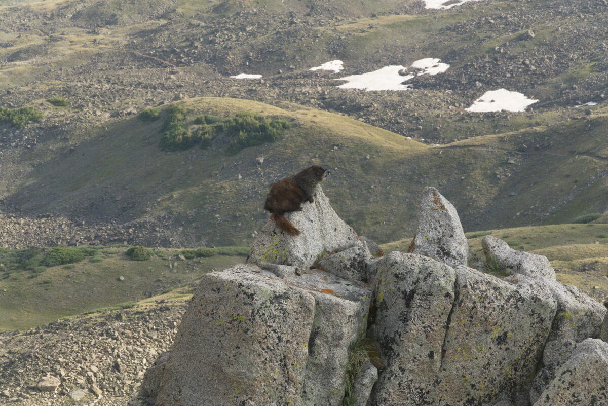
Of the larger mammals, I most frequently encountered deer. I did see an elk herd one morning, but never saw a moose, though I leapfrogged another hiker who said he saw one shortly after I passed him one day.
I saw three bighorn sheep on the trail right after the road walk at Waterton Canyon and some mountain goats in the Collegiate West.
I only caught a glimpse of a bear. While hiking on the side of a hill, I heard some crashing in the brush downhill from me. I looked that way, expecting to see a deer running off, and saw a large black shape instead.
Community
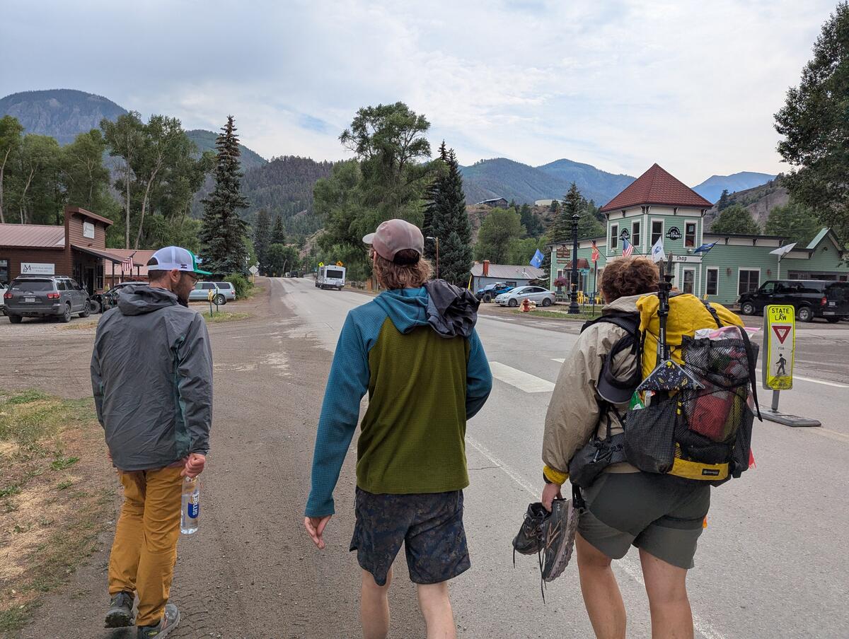
There were plenty of other people hiking while I was on trail. While I never picked up a tramily or made plans to hike with anyone, I started to see more of the same faces as I hiked. I suspect with a few more weeks I would have settled into a rhythm that matched some other folks. I found the community presence strongest in Lake City, which is a city where half the population might be hikers during peak hiking season. Having a longer timeline to find a crew that matched my style of hiking is a goal I'd have for a longer hike.
Getting into Town
Here's a list of how I got to and from all my resupplies:
- Waterton Canyon (mile 0): Lyft to the trailhead from Littleton.
- Breckenridge (mile ~100): Free shuttle system with a stop right where the trail crosses the road.
- Twin Lakes (mile ~180):
- To Leadville: Waited about 20 minutes (about 50 cars passed) until a man who was on a fishing trip in Colorado picked me up. He brought me as far as a gas station where he was turning off, and I got a quick hitch from the second car that passed me with two younger guys, one of whom was a rafting guide and had hiked the trail before.
- From Leadville: Met two other hikers at a hostel in the evening of my zero day who said they were leaving the next morning. I split the cost with them to get a ride from a woman who runs her own hiker shuttle.
- Monarch Pass (mile ~75 on the Collegiate West):
- To Salida: I asked for a ride to Salida from two mountain bikers returning to their cars at Monarch Pass late in the day after having no luck sticking out my thumb for 10-15 minutes or so. I cut this one close, it was 19:45 by the time I got to the pass, and hitchhiking in the dark doesn't seem like it would work well.
- From Salida: I actually ended up staying at the Butterfly House the night before I returned to trail, which is closer to Monarch Pass. They run a hiker shuttle into Salida for resupply and I got a ride with several other hikers who were headed back to the pass.
- Spring Creek Pass (mile ~350):
- To Lake City: A day hiker who was doing some trail magic at the pass offered me a ride.
- From Lake City: Community hiker shuttle.
- Durango (mile ~480): I asked a woman if she would take a picture of me as I finished the trail in Durango. She said if I were still there when she was leaving she'd give me a ride to town. Another woman walking by at that time said she was leaving and would give me a ride instead.
Overall, I preferred getting rides by meeting people in-person first and then asking, and found this to be much more effective than the traditional thumb-out hitchhiking style. It's much easier to ignore someone sticking out a thumb on the side of the road, and there's basically no opportunity for a personal connection before making the ask.
Towns
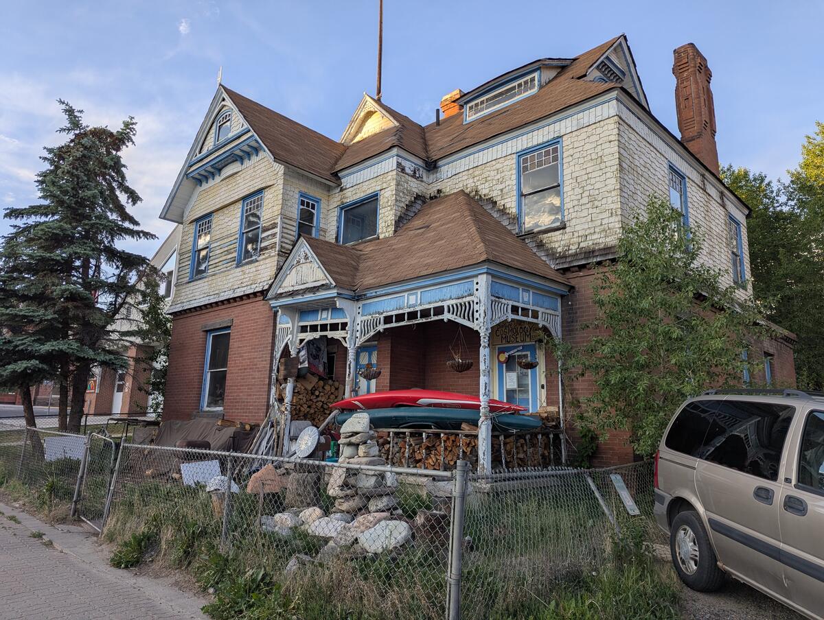
While I wasn't in town for very long, I enjoyed passing through them to get a sense of the vibe of each of them. Some quick reviews:
- Breckenridge: A quaint ski town, but upscale and expensive. A more budget friendly option would be to go north to Frisco, Silverthorne, or Dillon, which are served by the same bus system.
- Leadville: The highest incorporated city in the US is … kind of a dump. There's a nice block or so downtown, but it really degrades after that, with houses looking like they need at least a paint job, random clutter in yards, and decrepit sidewalks that start and end inconsistently. Please don't cancel me for this take.
- Salida: Several people spoke fondly of Salida, and it seems like a nice town, but my experience there was tarnished by the fact that there was no vacancy anywhere in town when I rolled in Friday evening. One of the hotel clerks told me that this happens nearly every weekend in the summer. So really my issue is that the businesses of Salida do not understand how to clear a market.
- Lake City: A true CT gem. This is a tiny little town populated half by retired Texans and half by thru-hikers. There is basically no reason anyone would visit Lake City if not for the CT and CDT; there's no nearby skiing to boost the economy. Rocky Mountain PBS released a recent video on the legendary hiker center there that I think captures the vibe well. I hear Sunday dinner at the hiker center is great, but unfortunately I arrived Wednesday evening.
- Durango: According to locals, Durango's popularity has taken off recently. I found that it was not as hiker-friendly as other towns—there were no go-to hiker hostels nor other natural gathering places for the hiker community. Durango is also built on car-brain. Outside of the small downtown, it's dominated by a loud, wide road. To cross this, there are unsignaled crossings with buckets of flags that you can wave to provide target practice to the trucks.
Retrospective
Gear
I had no major gear issues on trail, but I'm planning on making a few minor changes in the future:
- No bidet: I carried the CuloClean bidet, which fits in my water bottle, but decided to try not using it to minimize fuss. I found just using the sports cap on my water bottle worked just as well, so I'll drop the bidet attachment in the future.
- Replace my USB-A to USB-C cable with a USB-C to USB-C cable: My power bank has two USB-C ports, so having only one USB-C to USB-C cable meant that I could only charge one item at a time. I like to keep an eye on my electronics and not let them sit sucking power overnight, and felt bottlenecked by only being able to charge one item at a time. I'll probably drop the USB-A to USB-C cable next time so I can charge in parallel.
- More than one pair of Darn Tough socks: I wore the same pair of Darn Tough socks every day over two pairs of Injinji liners that I would swap. The socks wore out several hundred miles in and developed huge holes in the balls of the feet. I'll consider carrying multiple pairs next time so then I can double the amount of distance I can get out of a single pair of socks.
- 32" waist pants: I wear a 34" waist for most brands of casual pants, and got a 33" waist for my hiking pants, sizing down because I wear less baggy underwear on trail. By the end, I was cinching the drawstring pretty tight, so I think I probably need 32" waist pants instead. I'll also probably bring a belt, since I found dealing with the drawstring annoying.
- Underwear: I have always been a boxers guy for casual wear and usually wear compression shorts for exercise. Briefs ride up my leg. Despite knowing this, I somehow convinced myself to try briefs for this hike. Sure enough, the briefs rode up. Back to compression shorts it is.
- No gloves: I brought a light pair of gloves that I never ended up using given it never got that cold. In the future, I might try and replace the gloves with a dual purpose item, like an extra pair of socks, that could serve as a pair of mittens on a cold morning.
- Less warm quilt: I'm unlikely to actually replace my quilt, which I really like, but it did seem like a bit too much insulation, especially the first few nights, which were quite warm. I think having a 30° quilt would have been fine. I met a Nobo CDT hiker using a 40° quilt, so it is possible, but she said she would wear extra clothing to bed and still got cold at night.
- Shoes: I'm suspicious that my Topo Pursuit 2s were causing me achilles and bottom of the foot discomfort. Shoes wear out fairly quickly so I'd probably end up switching these out anyway, but I'd like to see if I can resolve some of this with a different pair of shoes.
- Chafing: This was probably one of my biggest discomforts on trail and one I'm still not sure I understand the cause of. At one point I thought my chest strap heart rate monitor was too tight, but loosening that didn't seem to help. I now suspect it's chafing from the thin cords of the pad attachment system that I use to secure my foam pad to my Nashville Pack Cutaway. I think the solution here would be to drop the pad attachment kit that I use to keep my foam pad on the outside of my pack and just put the mat inside my pack. This would make it harder to access the pad when stopping, but by the later sections of trail I could barely be bothered to take the pad out of the attachment kit anyway, so I don't think this would affect the way I hike much.
- Foam pad: An alternative to solve my chafing issue would be to switch to one of the egg crate-style foam pads, where the cord of the pad attachment kit could sit between the lumps and wouldn't rub so much against my back. I'd also like to start using foam pads for camp efficiency's sake. One of my least favorite chores in the morning was pressing out all the air from my inflatable pad and trying to fold it nicely.
- Replace my dry bag with a pump sack: While claims that blowing up air mattresses with your mouth may introduce mold are BS, one practical problem I faced when replacing my nylofume pack liner with a dry bag to use as part of the Matt Shafter pillow was that air would always get trapped in the dry bag. I got better at squeezing it out when repacking my sleeping gear in the morning, but I still often had to squeeze and roll multiple times. With a pump sack, I'd just be able to drain the excess air through the valve.
- Switch filtration methods: I got so tired of squeezing that damn Sawyer on trail. While the mosquitoes in the Holy Cross Wilderness taught me to do this while walking, I still found it tedious and tiring, so I'm considering switching to some kind of chemical filtration system.
What went well
- Gear: I had no major repairs that I had to do in the field. I felt that I had everything I needed, e.g. I never missed my puffy.
Bear hangs: were my bear hangs actually that good, or were they never tested? Likely my success with bear hangs was due to the fact that they probably were not tested, but I was also pretty proud of some of my hangs and got fairly good at doing them.
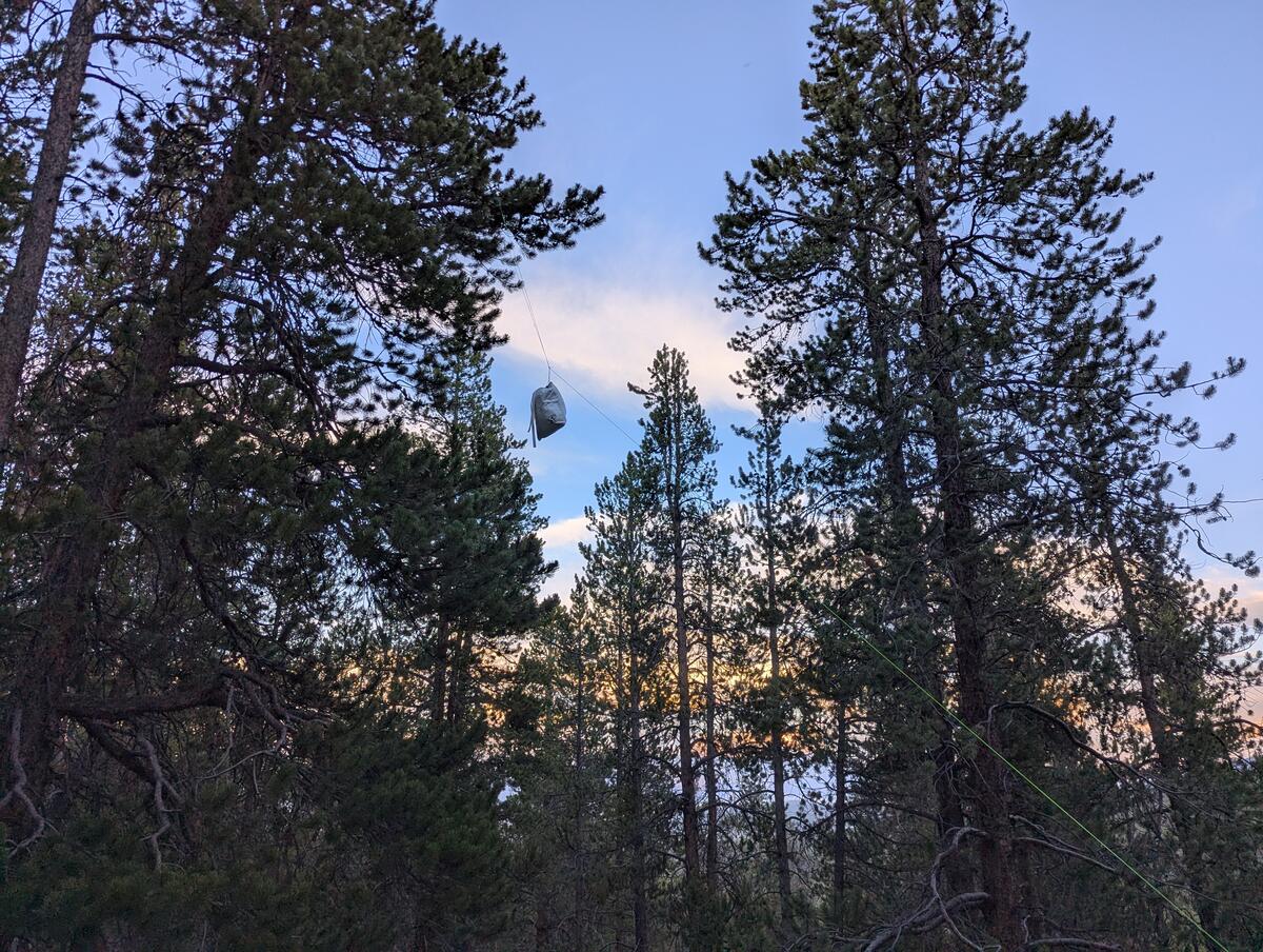
A bear hang I did on trail - No major animal issues: Relatedly, the most aggressive animal I experienced was a marmot.
- Storm management: I never felt like I pushed my luck too much with storms. I met people who were both more conservative and more aggressive, but I was happy with where I drew the line.
- Physical performance: I hiked my longest day yet on this trail, 38 miles / 60 km. In general, I was able to put away some pretty long days while mostly feeling good.
- Altitude: I've spent enough time at altitude to know that I'd probably be okay after a few days, but I really threw myself right into it on this hike—starting it on the day I flew into Colorado from sea level. I found that I started to feel really good on my third day of hiking. I had no further issues with altitude, neither with hiking nor sleeping.
Extra credit peaks: I wanted to bag Mt. Elbert since it's the state high point of Colorado and I was walking literally right past it. I made it there as well as the summit of one other 14er: San Luis Peak. Only 56 to go!
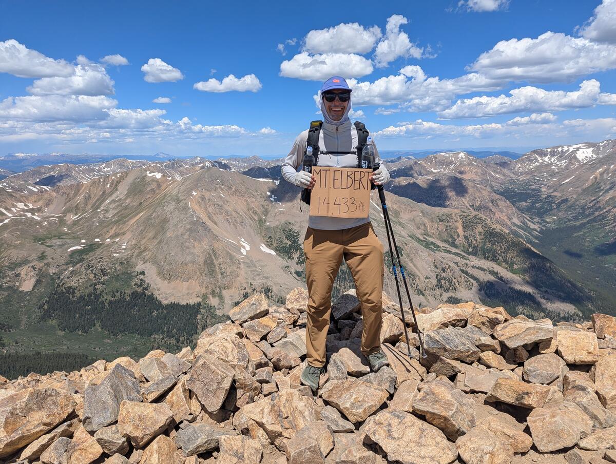
Yours truly at the summit of Mt. Elbert - Hiker community: I got a good sense of what the thru-hiking community was like during this trip, after experiencing a lot of solitude on the TRT. I was able to interact with lots of hikers and hiking-adjacent folks like trail angels. Particular highlights included the hiker center in Lake City, the Butterfly House close to Monarch Pass, and the trail magic from Turtle at Lujan Pass.
What could go better
- Overall, one of my big areas of improvement is that I'd like to be more efficient with my non-hiking activities. Even by the end of my hike when I had refined my routine, it would take about an hour and fifteen minutes for me to get out of camp in the morning, and about two and a half hours for me to complete all my camp chores in the evening (set up tent, set up bear hang, eat dinner, stretch, journal). I have some ideas to decrease time in camp:
- Stop bear hanging: This was probably not necessary for me to do anyway given that I have a bear-proof bag, and it takes a while even with the right tree. I'll probably just tie my bag around a tree in the future. Several other hikers that I met slept with their food. I'm not sure if I'm ready to do that yet, and this is technically disallowed on most of the Colorado Trail anyway.
- Eat dinner before camping: This wouldn't necessarily save me time, but it would decrease the number of tasks I have to do upon arrival to camp. There are other benefits with doing this as well, notably that I'd give myself more time to digest my food before bed, which would probably improve the quality of my sleep.
- Switch to a foam pad: While inflatables are quite comfortable, a foam pad is much easier to manage and I'd like to see if I can get away with using one.
- Campsite selection: I'm beginning to think a perfect campsite is a myth, especially on the Colorado Trail, but I still think I could do a better job with this by increasing the range in which I look for a campsite and having ideas for multiple candidates. Common issues I had were dealing with roots, mosquitoes, and ground that was not entirely flat or level, especially in the lush second half of the trail.
- Strain on feet: On some of my longer days I noticed that my achilles and underside of my foot in general would start to ache. This sensation always went away the next morning and I suffered no longer term injuries from it, but it could make the ends of my days unpleasant. I suspect this is a shoe issue so I'm excited to try some different shoes and see if my issues here are resolved.
- Stress: There were several evenings where I felt like I really had to push to find a campsite and set up camp before it got dark. While setting ambitious goals for the amount I want to hike and pushing beyond them is rewarding, it's also stressful.
Where I got lucky
- Storms: there were very few day-ending storms while I was on trail. Overall, the dry monsoon season was good for allowing me to hike bigger days.
- Water as trail magic in segment 27: One of my biggest mistakes on trail was deciding on day 22 to carry less water, since I had been going through the wet San Juans where there were so many streams. On this day, I entered section 27 with maybe a swig of water left in my bottles, and was shocked to find that I had 12 miles until the next source. Even after taking a liter of that and drinking it, I was still pretty dehydrated by the time I got to the next naturally-occurring water source. Having to rely on trail magic like I did in this section was an oversight on my part.
My subjective trail review
This trail is hard. I came into it thinking from my experience on the Tahoe Rim Trail that I could crush this trail in like 20 days, but the realities of dealing with the terrain put an end to those goals, especially after leaving Breckenridge and into the Collegiate West section.
The first 80 miles or so are pretty cruisy, which is a good warmup if going SOBO, but the trail gets much more interesting after Breckenridge. While the climb out of Breckenridge is hard, it's extremely rewarding, and the next above treeline section around Kokomo pass is one of my favorite sections of trail.
I still think my second day in the Collegiate West section (day 12) was my hardest and most stressful day of hiking overall. I set myself up for this: I didn't want to camp below treeline and so had to push through a 15 mile above-treeline section at the end of the day featuring at least four 12,500+ ft passes.
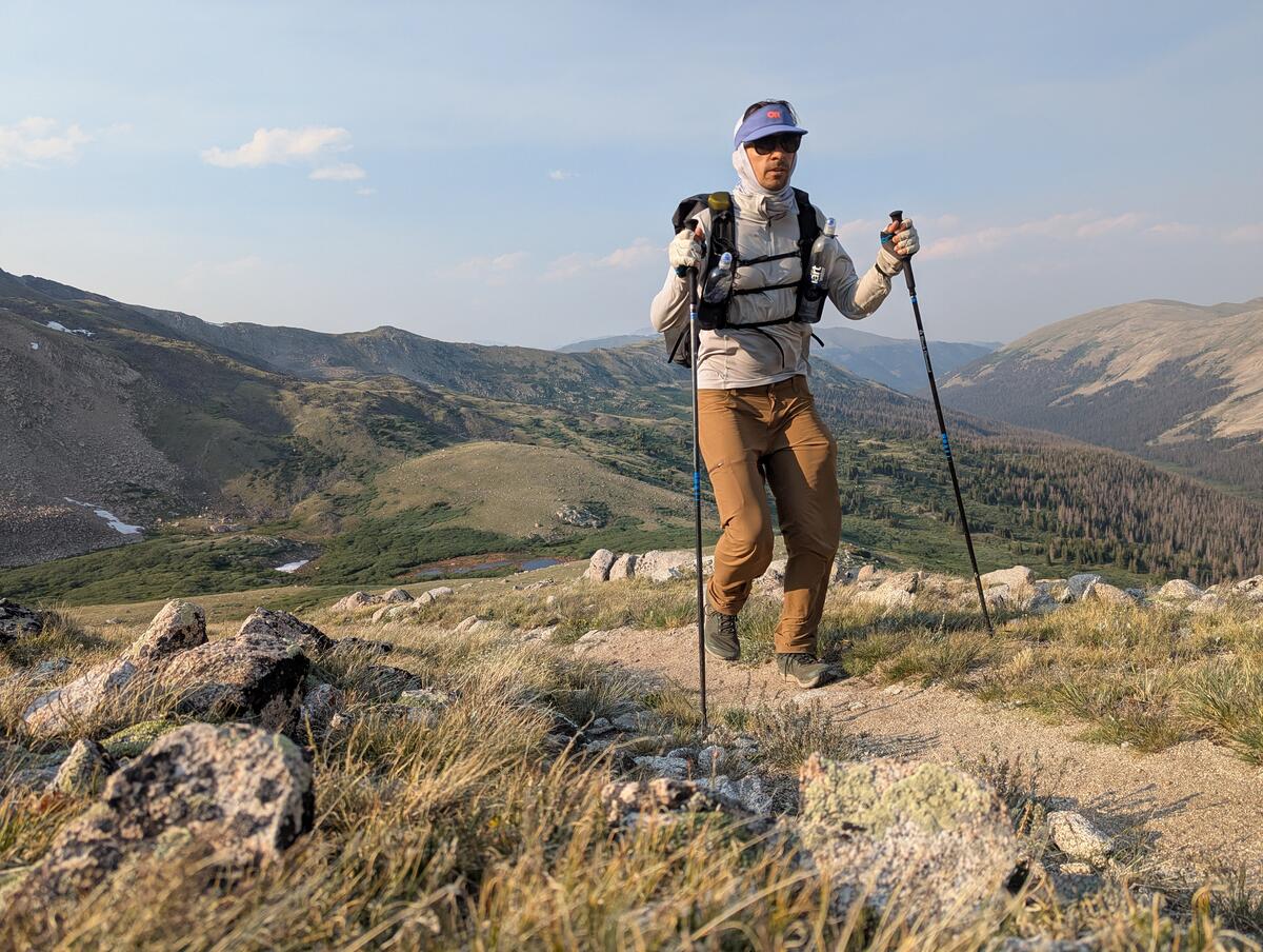
One of my least favorite sections overall was Sargents Mesa, which traverses a ridge from mile ~280 to 300. While it's not high elevation, it's slower going than I expected because there are steep, loose ascents and descents. These have very little payoff since they ascend to hills along the ridge that are in the trees and have no view.
While the next section with its numerous cows and cow-contaminated water is much maligned, I didn't find it that bad: there are some open sections with nice views, and it's quite flat, so pretty quick going.
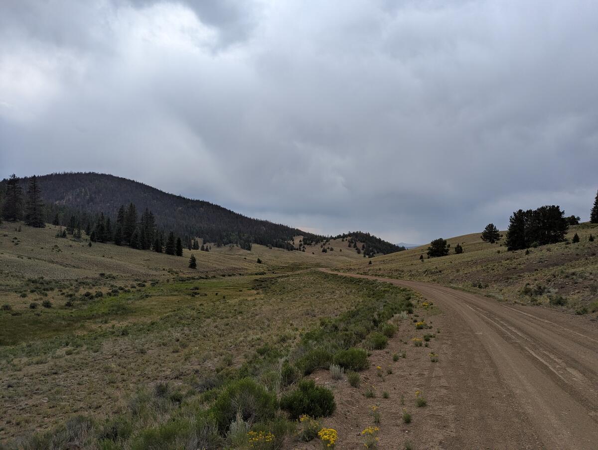
The San Juans were probably comparably difficult to the Collegiate West, but I found them much more beautiful and therefore enjoyable. There are a lot more flat, alpine sections with wildflowers, which includes the section featuring the CT high point. This makes them feel like much less of a grind than the Collegiate West section. I also just bit the bullet and camped near treeline for my first night out of Lake City, which let me take on several of the high passes in the San Juans earlier the next day when I was less tired.
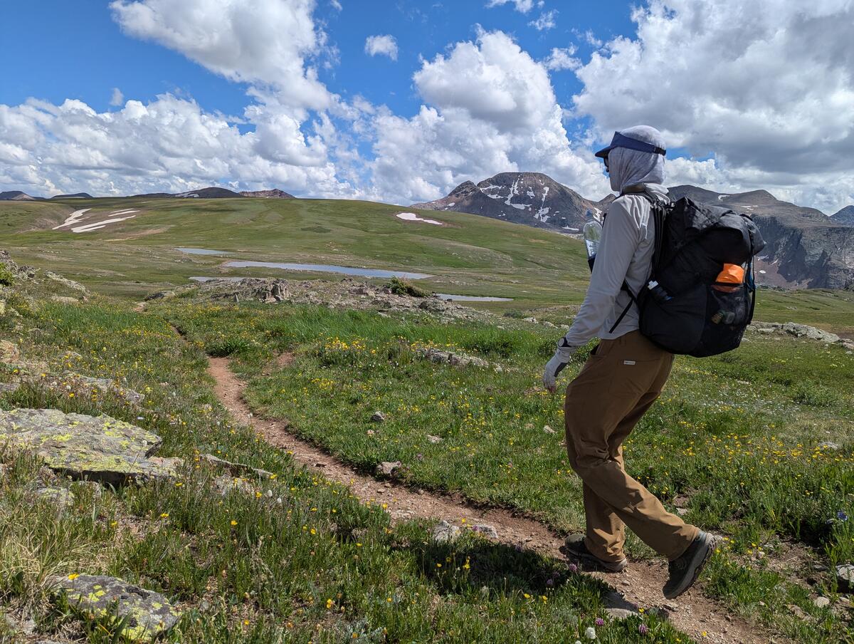
The majority of people hike the CT SOBO, and this is for good reason: the San Juans are great to save for last, when you've maximized your acclimation and so the trail finishes on a high note.
How did I do on my goals?
I chose to hike the CT for five reasons
- Longer: I did manage to hike my longest day on trail yet at the end of the CT—38 miles. Despite this, my legs never felt as good as they did on the TRT. In terms of resupply, I definitely started to get the hang of what to get and what I enjoyed on trail, though I did get tired of the food I was eating by the time I finished trail.
- Higher altitude: I do well at altitude. It only took me a couple of days to get adjusted and I never suffered any major ill effects beyond just slowing down.
- Storms: While I was always looking for storms, I only had to deal with a couple of major storms on trail.
Peak hiking season: The CT has a much better community around it than the TRT. Partially, this is because the CT is a longer trail. This gave me a chance to run into people multiple times and find a few people who were hiking at a comparable speed to me. Even with people I didn't see multiple times, the experience of being on trail naturally gives me something to talk about with others, which made it easy to connect with people even if they were heading the other way.
I'd guess that the CT also draws more people than the TRT. While the TRT section that overlaps the PCT has more hiker amenities, the smaller number of thru-hikers in other parts of the TRT make it hard to create businesses that cater specifically toward hikers. A town like Lake City, where hikers form a not-insignificant chunk of the population, just doesn't exist in the Tahoe area.
- No permit: This is one of the best parts about the trail. While there's definitely a bubble, I never felt like the trail was too crowded and it's still possible to find solitude, so I hope the CT remains permit-less, or at least quota-less, for the future.
What's next?
By the end of the CT, I was ready to get off trail. While a lot of folks feel the ending of the trail is bittersweet, I love my creature comforts and was ready to return to them. I was a bit worn out by the stress of "where am I gonna camp tonight?"
A couple days after getting off trail, though, I was already thinking of what my next adventure would be. I have a few on my short list:
- The Long Trail: The easternmost trail on the "triple Tiara". This would be a nice change from the western thru-hikes I've done.
- The Arizona Trail: The lushness of Colorado started to wear on me after a while and made me think that a desert hike, where plants are not constantly touching my legs, would be a nice change.
- The PCT: This would require a lot of coordination to do given my corporate job, but of the three long trails, it's the one that I'd be most interested in.

